 wider area
of old
Edmonton Edmonton
old
town Silver Street
Edmonton large
houses
Edmonton cinemas
in old
Edmonton then and now
Edmonton old rural
Edmonton the
windmill
Edmonton old
Edgware

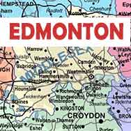
The wider area of old Edmonton UK
There are many more mentions of old Edmonton on this website because so many of the recollections stem from there. Just put Edmonton into the search box.
____
By John Cole who lived in the area
At the time when the Huxley Estate was developed, Edmonton was mainly rural as can be seen from the map further down the page.
There were small pockets of small workers' houses situated behind i.e. to the west of Hertford Road, and the railway was built to skirt these. To the west of the railway were mainly fields, with small hamlets dotted about. The rest was agricultural. When our parents grew up in the early 1900s there was nothing to the north of Cheddington Road, and at the west end of Henley Road and Oakfield Gardens was a nursery, as there was to the west of Windmill Road. Yes, I remember the remnants of the windmill.
There were houses along the north side of Silver Street and these were larger than those of the Huxley estate, so I think they were privately owned, as was the Clarke house on the south side of Silver Street. I am dubious about the southern ends of Bulwer Road and Sheldon Road. I remember them as being slightly larger and of a different design from the others on the estate but I am unsure whether they were estate or private.

1894 map of the Edmonton area showing its rural nature and the earliest roads of the Victorian terrace houses. Tap/click for a larger image.
There were three parallel transport routes running due north from London:
- First was the Hertford Road, now Fore Street, Edmonton, which ran from the City via Stamford Hill, Tottenham and Edmonton. Development then petered out on its way north to Hertford and beyond. It was popular with city gentlemen because it was a convenient coach ride from the city and gave rise to the grand houses that bordered it through Stamford Hill, Tottenham and Edmonton (now non existent or split into flats).
- Next was the Lea canal, based on the river Lea which was broadened and deepened where necessary. This gave rise to factories and warehouses along its banks about as far as Brimsdown (north of Enfield). The main trade was in timber which came by barge from the Pool of London and the manufacture of timber products, especially furniture in the Tottenham, Stamford Hill and Stoke Newington areas where Jewish communities grew up. In Edmonton where the A406 (Angel Road) crosses the river, I used to fish. I remember the tow path, horses pulling barges and the smell of sawmills in the factories. To the east of the river, towards Chingford and Walthamstow, was marshland, pretty well all the way along until the ground rose northwards beyond Brimsdown, where flooding stopped and the Lea Valley nurseries began (hence the need for pots). To the west of the river, between it and Hertford Road, was a belt of small factory workers' houses (now mainly cleared during slum clearance after the 2nd world war).
-
Third was the railway from Liverpool Street to Enfield which gave rise to hamlets springing up around each station which were about a mile or so apart. These hamlets mainly housed artisans and clerks who worked in the city but some of the better off factory workers moved west from the river Lea/Hertford Road area to them. Upper Edmonton, which grew up around Silver Street station was one of these.
| sources | webmaster | contact |
Text and images are copyright
If you can add anything to this page or provide a photo, please contact me.

