 wider area
of old
Edmonton Edmonton
old
town Silver Street
Edmonton large
houses
Edmonton cinemas
in old
Edmonton then and now
Edmonton old rural
Edmonton the
windmill
Edmonton old
Edgware

Rural Edmonton UK: recollections and photos early 20th Century

Photographs with commentaries on rural Edmonton UK around the early 1900s: Pymmes Park, Sluice Gate Weir Hall, Lambs Institute, Pymmes Brook, the weir and more.
There are many more mentions of old Edmonton on this website because so many of the recollections stem from there. Just put Edmonton into the search box.
The quality of the following photos is variable. You may be able to see more detail on a phone or tablet by pinching out.
____
Labelled Tottenham Sluice Gate, Weir Hall, courtesy of Enfield Local Studies and Archives.
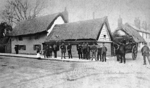
Church Street, Edmonton, the site of Lambs Institute, c1900. Photo courtesy of Brenda Noble.
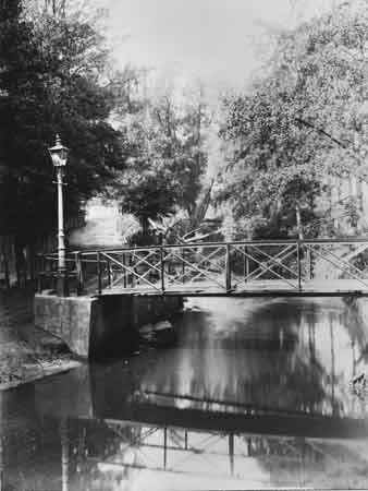
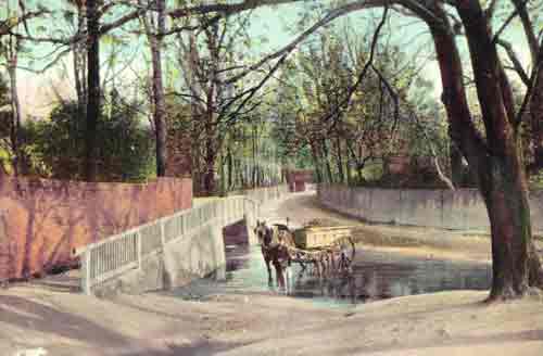
Labelled Weir Hall, although I understand that Weir Hall was a country house, so presumably this was either the garden or a local name for where the Hall once stood. Edmonton, north London, 1920s.
Both this photo and the one immediately below are from the effects of my mother.
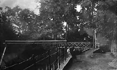
This first photo shows another view of the bridge and lamp post in the above picture.
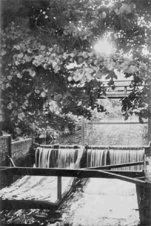
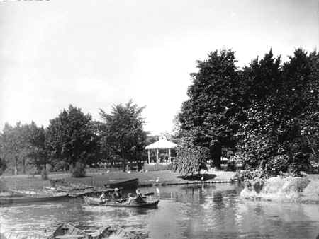
The weir, Pymmes Park
Pymmes Brook c1906. Photo from Cliff Raven, courtesy of Enfield Local Studies and Archives. He has supplied the following information:
This picture is seen from the first of the above bridge pictures (with the lamp post) looking west, with the boundary fence of Weir Hall house on the left. The wicket fence in distance left centre is now where the Cambridge A10 passes from left to right. In the middle distance can be seen what one may think is a bridge, but was a big pipe, removed in the 1975 Road changes.
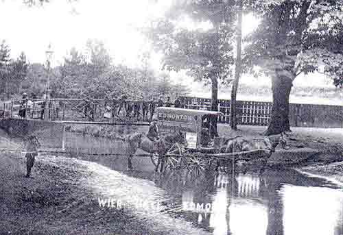
Water ford splash, Pymmes Brook. Photo from Cliff Raven, courtesy of Enfield Local Studies and Archives.
The photo shows the water ford splash, from the northern bank of the Pymmes brook circa 1906. If you travelled in the direction that the cart is facing, you would come up an incline to the Silver Street at the point of where Silver Street school is just out of shot. The road track coming from the right is Weir Hall Lane and was so named up onto Silver Street, which prior to 1894 Ordnance survey map was called Wyer Hall Road. The track opposite leading to that red roof building was Hermitage Lane, and the part to the right has now in modern times also been called that, so Weir hall Lane has now disappeared as a name. The boundary fencing with trees beyond is of the Victorian Weir Hall House grounds. This became, in its later days, a school for young gentlemen, hence the mention above of the smoking room, billiard room and ballroom. It was surrounded by a moat which I would think was fed by the waters of the Pymmes brook. - Cliff Raven
There was another building on the Weir Hall site which had a ballroom with mirrors for walls. Another room was decorated with cork. An original mounting stone was outside. Information courtesy of Brenda Noble.
| sources | webmaster | contact |
Text and images are copyright
If you can add anything to this page or provide a photo, please contact me.

